This race follows the route of the Dronfield 2000 Rotary Walk
2024 Race Date: Sunday 14th July 10:30am – confirmed
- Date: Sunday 14th July 2024
- Start: 10:30am
- Start location: Track behind the Angel Pub, Holmesfield
- Route (PDF): Click here
- Organiser: Steel City Striders
- Official site: Here
- Ext map link: Here
- About: 3 legs, circular route. Each leg is about 4 – 4.5 miles. Teams of 6 running in pairs or solo
- Terrain: Mainly off-road through fields and on trails
OS maps
- Leg 1 Start: Track by St. Swithin’s Church car park, Holmesfield, S18 7XA (Google Map link)
- Leg 2 Start: Car Park behind Coal Aston Village Hall, S18 3AU (Google Map link)
- Leg 3 Start: Top of Half Acre Lane, B6057, S18 1ND (Google Map link)
Leg 1
Leg 2
Leg 3
Dronfield Relay / Dronfield 2000 Rotary Walk – full route
About the Dronfield Relay
The annual Dronfield Relay is a very low-key local event organised by the Steel City Striders.
The course is a circular route made of three stages. Teams are made up of six runners with a pair running each stage. Each stage is under 5 miles each making the whole circular route a total of around 14.5 miles through the countryside around Holmesfield, Dronfield and Coal Aston.
OS map
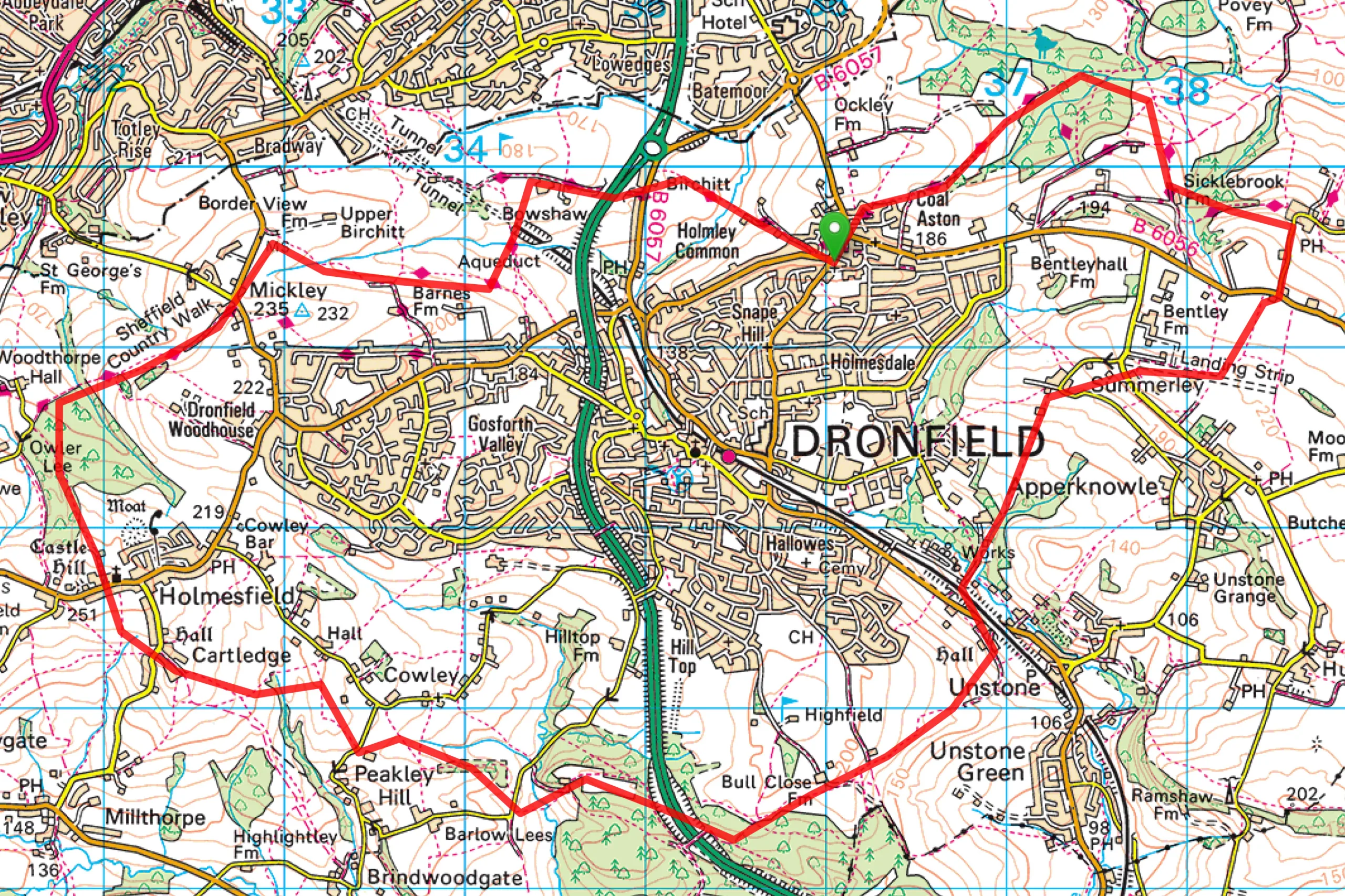
Dronfield 2000 Rotary Walk
The Dronfield 2000 Rotary Walk is a millennium project by the Rotary Club of Dronfield (now run and managed by the Dronfield Heritage Trust). The route of the 14.5 miles circular Walk is well marked in both directions, however, clockwise seems to be the most common direction.
Officially, the start is in Coal Aston, however, we normally start in Holmesfield
The route is mainly off-road and takes you through open countryside and through woodland. It can be an extremely muddy route at some times of the year